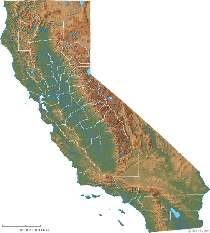
Here's a nice colorful map to show the different regions of California. We discussed the mountain ranges (Coastal and Sequoia), the Central Valley, the desert regions (Mojave, specifically) and the differing climates, plants and animals.
Here's a nice selection of printable maps of California.
We discussed the state symbols: flag, motto, bird, flower etc. This was just an overview, with no requirement for memorization of this information.
California State Flag Online Coloring Page I like activities like this since they use no ink to print, create no paper to manage, are fun and engaging for a time and teach mouse skills and hand/eye coordination.
Lots of printable and interactive activities
Mission Pictures We briefly discussed missions, but we do not devote very much time to them. We looked over the pics we took at Mission San Buenaventura when we visited and talked about how the Spanish helped and hurt the Indian culture.
We played a game with California trivia.
We learned about the failure of the Kaweah Colony. This area isn't too far from us, and we have been to the site in the past.
Here's an Amazon Listmania that I found helpful.
We watched a neat video clip of Market Street in San Fransisco days before the Great Quake. We also looked at lots of pictures of the aftermath and compared the with the 1989 quake in Loma Prieta. This, of course, led to a discussion of earthquake preparedness, the reasons we prep, and the real-time earthquake map I have bookmarked. Go to the left sidebar to change to a view of the whole USA or the world.
Books we read:
Nine For California by Sonia Levitin
John Muir by Charles Graves
If You Lived At The Time Of The Great San Francisco Earthquake by Ellen Levine

No comments:
Post a Comment
I love comments! Please feel free to leave kind words, new ideas, requests for recipes, even gentle criticism if needed in the spirit of Proverbs 16:24.
"Pleasant words are as an honeycomb, sweet to the soul, and health to the bones."